Edit a digital map
Use a simple mapping app to edit a digital map, add landmarks, labels, paths, and symbols to represent real places and learn map basics.


Step-by-step guide to edit a digital map
How To Make A Great Digital Map
Step 1
Open your chosen mapping app and sign in to your account.
Step 2
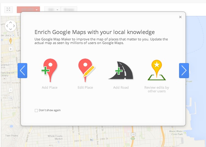
Tap or click to create a new map or project.
Step 3
Give your map a fun name and write one short sentence describing it.
Step 4
Zoom and move the map to the neighborhood or area you want to edit.
Step 5
Add markers for at least three landmarks like your home school and a park.
Step 6
Change each marker's icon so it matches the place (choose a house icon for home a tree for a park etc.).
Step 7
Add a clear label with the name of each place to each marker.
Step 8
Type a short description or fun fact for each marker so people know more about it.
Step 9
Use the draw line or route tool to trace a path between two important places.
Step 10
Use the polygon or shape tool to draw an area around a park playground or school yard.
Step 11
Attach one photo to at least one landmark so viewers can see what it looks like.
Step 12
Save your map so all your edits are kept.
Step 13
Share your finished creation on DIY.org
Help!?
If we don't have the exact mapping app used in the instructions, what can we substitute so we can still create and share the map?
Use any mapping app that lets you sign in and create a new map or project (for example Google My Maps, Bing Maps, or Mapbox Studio), or take a clear photo of a drawn paper map and upload that image when you share on DIY.org.
What should we do if markers, icons, or an attached photo won't appear or the map won't save?
Make sure you're signed in to the account, click the map's Save or Publish button after editing, re-add each marker and change its icon again if needed, and reattach the photo to the landmark before sharing.
How can we adapt the activity for younger children and for older kids who want a challenge?
For younger kids have an adult sign in, zoom to the area, and add just two simple markers (home and park) with house and tree icons and one photo, while older kids can add more than three landmarks, write longer fun facts, use the polygon tool for multiple areas, and trace detailed routes between places.
How can we enhance or personalize the finished map beyond the basic steps?
Personalize it by choosing custom icons for each marker, adding color-coded labels, writing creative fun facts for every place, attaching multiple photos to landmarks, tracing a themed route with the draw line tool, and saving before sharing on DIY.org.
Watch videos on how to edit a digital map
How to make digital maps using Map maker interactive
4 Videos
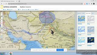
How to make digital maps using Map maker interactive
How to Create a Clickable Interactive Map in Canva
Step by step guide to making an interactive map with no code
Create a Digital Concept Map (FREE) | WISEMAPPING TUTORIAL FOR TEACHERS
Facts about digital mapping and basic map skills
🗺️ OpenStreetMap launched in 2004 and lets anyone edit maps — it's like Wikipedia for places.
✏️ Cartographers use simple symbols and a legend so a tiny icon can tell you 'park', 'school', or 'playground'.
🛰️ GPS relies on a network of satellites and can often locate a smartphone to within about 5–10 meters.
📐 The Mercator map projection (1569) keeps compass directions straight but makes polar regions look much bigger.
🔎 Adding landmarks and labels to digital maps helps others find places, and your edits can show up in minutes to days.
How do I edit a digital map using a simple mapping app?
What materials do I need to edit a digital map?
What ages is digital map editing suitable for?
What are the benefits of having children edit digital maps?
